Maybe it was luck, maybe it was climate change
Long Path Sections 20 + 21: Phoenicia to Mink Hollow
This is the tenth installment of a series on section hiking the Long Path, a long-distance trail that runs over 350 miles from the West 175th Street subway station in New York City to John Boyd Thacher State Park near Albany. The adventure begins here, and you can read the previous installment here.
Phoenicia to Baldwin Memorial Shelter
After the long descent from Romer Mountain, the Long Path passes through Phoenicia—where E and I picked it up one sunny October afternoon—before leaving town on a narrow highway that follows the winding course of the Esopus Creek. Late afternoon light slanted through the last of the yellow and red-tinged leaves, bathing the scene in a golden haze. It was pleasant walking, although after the sidewalk vanished I hugged the nonexistent shoulder in doe-eyed fear whenever cars or trucks approached, the edge of the road on the outside of the yellow line crumbling away beneath my feet.
The bus had dropped us off on Main Street around 4 pm, so we had just about two hours of light to hike three or four miles to one of the shelters on Tremper Mountain, including this easy road walk. We missed where the Long Path veered into the woods but no matter: there was a trailhead and parking lot right up ahead, and that trail soon joined the old woods road we were meant to take. What’s another tenth (or two) of a mile between friends? Plus, this way a hiker on her way out was able to warn E that she had come across a bear.
Backpacking in the Catskills in late October can involve snow, sleet, or freezing rain. Hikers the weekend before had posted photos of ice-crusted evergreens on nearby Panther Mountain. We had checked the forecast ahead of time and knew most of the days would be dry and mild, but I had heeded the suggestion of a cautious old timer on Facebook (I appreciate that the Catskills trail conditions group is open to everyone so you can see it even without an account) and brought our traction devices, just in case.
I shouldn’t have.
Maybe it was luck, maybe it was climate change, but as soon as E and I started the steady slog up Tremper, we were both wondering why we hadn’t worn shorts. Beads of sweat broke out on our brow and we delayered as much as possible.
Fewer leaves clung to the branches up on the mountain. Instead, they blanketed the ground—hiding the loose rocks that twisted and turned our ankles this way and that. As we climbed I wondered what had happened to the fitness I should have acquired during my recently-aborted marathon training? Why is backpacking always so hard?
So I huffed and I puffed my way up the mountain, racing the sun that had already sunk below the next ridge over. When we got to the turnoff for the first shelter—just as twilight was settling in—and found it empty, we claimed it. Soon an orb was rising behind us out of the trees: an almost-full moon, like a pearly-bright spotlight.
After dinner, E stayed up reading by headlamp while I fell into a stupor of a sleep, so thick and exhausted—which I blame as much on a poor night of sleep the day before as on the measly three miles of hiking—that it seemed almost drugged.
E woke me several times that night: Once, because there were hikers talking loudly nearby, and it seemed like they might come to the shelter (they didn’t). Then again because he heard a large something making rustling noises somewhere a bit further down the mountain, which might have been a bear; I told him to clap loudly and rolled over to go back to sleep, hoping for the best and grateful for my alert, light-sleeping hiking partner. Later (I might have got the order of these mixed up) something woke E again, and when he turned on his headlamp a porcupine was staring right at him. By the time I sat up he (the porcupine) was displaying his rump and looking back at us insolently, before ambling away.
I told E to move his backpack inside because I once heard porcupines like chewing on sweat-stained things—like shoelaces, or backpack straps—for the salt. The next day we noticed the straps he uses to attach our sleeping bag to his backpack looked odd, like something had gummed at them, but we weren’t able to confidently attribute it to our nighttime visitor.
Baldwin Memorial Shelter to Mink Hollow Shelter
After breakfast we filled our bottles directly from a streaming pipe sticking out of the ground, no filter required. The way water (sometimes) bubbles and gurgles out of the Catskills in a plentiful, sweet, clean gush is something I hope I never take for granted.
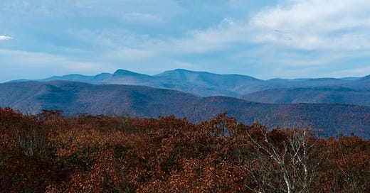
After climbing the Tremper fire tower (excellent view, as expected, but photographs never seem to capture it), we began a very long gradual descent. The sun was shining, our moods were high, we were just a smidge too warm. A shirtless hiker with an orange watch cap on told E he was bushwhacking a couple nearby peaks. A NYNJTC volunteer we met a bit further on said he and his partner were there to hike one of the new “next 100 tallest peaks” after the 3,500 footers. What was wrong with the original “next 100 tallest peaks” list you ask? He said 18 of those were on private land. The new list only includes peaks on public land: thus, the “next tallest 100 public peaks.”
He asked where we were headed that evening and if we had ever been on this particular trail before. “Nope,” we replied. “Well, it just goes all the way down, down, down to Warner Creek, and then all the way back up, up, up.”
He wasn’t wrong. We followed an endless series of steep switchbacks down to a rocky gash in the valley filled with a jumble of boulders and small rivulets and waterfalls running through. We stopped for lunch, thinking it might be the creek. It was not, of course it wasn’t.
When we did come to the creek, it wasn’t high. (It can swell up to the thigh, our new acquaintance said, and is unsafe to cross at those times, the guidebook warned.)
We began the long climb up Daley Ridge.
As we walked, E said he got a text from my mom: my dad had to go to the emergency room, and she didn’t know if she should tell me and spoil my hike, so she would leave it up to him. An extremely sweet impulse, but of course I wanted to know, and of course E told me immediately. The next time I had service, on a ledge heading up to Plateau Mountain, I texted to check in and find out what was going on, and waited to find out as much as I could.
We hurried over the easy meandering spine of Plateau. We had been here before, on our Devil’s Path hike a couple years ago, heading in the opposite direction, and Plateau had been a welcome respite then, too. There was no way we would make the shelter before dark.
We descended Plateau as the moon rose through the trees. I minced my steps—my knees were starting to feel the grind. Again, much like the last time I hiked down into Mink Hollow. But last time, the descent down Sugarloaf Mountain brought me to tears and nearly broke me. I am so much stronger now. I savored that thought.
We filled our bottles again from a pipe spring in the dark, pulling on layers against the evening chill, and headlamps to light the rest of the way to the shelter, which was—somehow—empty. We could only just make out a lone fire crackling at one of the campsites through the trees, but didn’t see the occupant until morning.
Hike it yourself (from NYC)
Trailways runs multiple buses from New York City to Phoenicia every day. This is one of the easiest sections of the Long Path to get to/from for New Yorkers. (Stay tuned for the second half of this section hike in a future issue of Pinch of Dirt.)